Perkins Island Light
|
Perkins Island Quick Facts
Year Station Established: 1898
Is the Light operational? Yes
Year Light First Lit: 1898
Year Automated: 1959
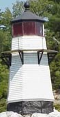
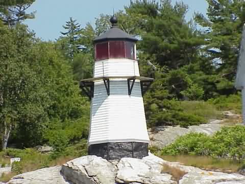
Shape: Octagonal
Tower Height: 23 ft.
Original Optic: 5th Order, Fresnel
Present Optic: 250mm
Existing Keepers Quarters? Yes
Year Constructed: 1898
Number of Stories: 2
Architectural Style: Victorian
Construction Materials: Wood
|
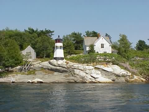
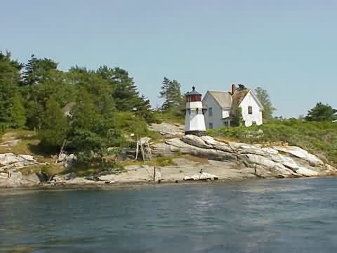
Perkin's Island Lighthouse
Near Georgetown, ME
More Photos
(7 photos, 165KB total download)
|
Last Visited: June, 2002
History:
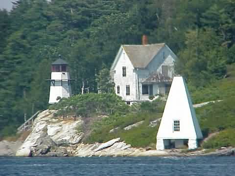
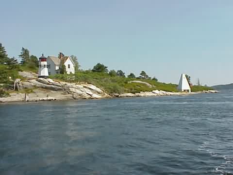
Several aids to navigation were erected in the Kennebec River in 1898 to aid mariners headed for the shipbuilding center of Bath. A 23-foot octagonal wooden tower, similar to those at Doubling Point and Squirrel Point, was erected on seven-acre Perkins Island near the mouth of the river. A two-story, six room keeper's house was built at the same time, as was a small barn.
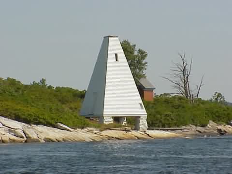
A boathouse, pyramidal wood frame bell tower (1902) and brick oil house (1906) were added shortly after the turn of the century. A 1910 inspection reported a 1,000 fog bell in use.Perkins Island Light originally had a fifth order Fresnel lens. The light was automated in 1959 and the lens was replaced by a modern 250 mm optic in 1979.
The fog bell was removed from the tower and is now on the grounds of the Georgetown High School.
The light station, except for the tower itself, was transferred to the State of Maine in the 1960s. In 1974 the Georgetown Conservation Commission ran a short-lived Marine Awareness Program for high school students on the island.
The Victorian keeper's house is in a state of severe disrepair. In late 2000 a restoration of the bell tower took place, funded by the Maine Department of Conservation and a New Century Program Preservation Grant, administered by the Maine Historic Preservation Commission. Local resident Joshua Bate was the project foreman and volunteers from around the state helped with the restoration.
Perkins Island Light remains an active aid to navigation. The lighthouse itself was leased in
May 2000 to the American Lighthouse Foundation.
Source:
American Lighthouse Foundation

Latitude/Longitude: 43.786767,-69.785264
Directions:
- The light can only be seen by boat. See the Lighthouse Tours page at Cyberlights for information on boat cruises in the Bath and Boothbay areas.
|


|