Presque Isle North Pier
|
North Pier Quick Facts
Year Station Established: 1858
Is the Light operational? Yes
Year Light First Lit: 1858
Year Automated:
Shape: Square
Tower Height: ft.
Original Optic:
Present Optic:
Existing Keepers Quarters? No
|
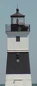
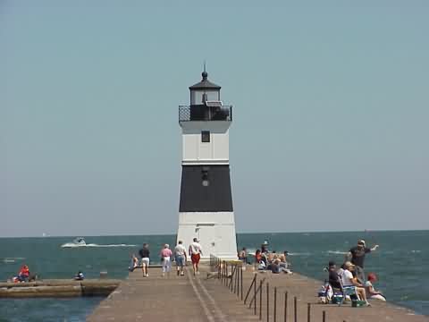
Presque Isle North Pier Lighthouse
Erie, PA
More Photos
(4 photos, 48KB total download)
|
Last Visited: August, 2002
History:
The Erie Harbor North Pier Light, also known as the Presque Isle North Pier Light, is one of the three lighthouses near Erie, Pennsylvania in the United States. The light, situated at the far eastern end of Presque Isle State Park, helps mariners as they traverse the narrow inlet between Lake Erie and Presque Isle Bay.
Originally constructed as a wooden tower in 1830, that light was swept away by a schooner in 1857. The current structure was forged in France and assembled on site in Erie. It was moved in 1882 and again in 1940. The United States Coast Guard, which operates the beacon, changed its fixed red beam to an automated red flashing light in 1995, at which time the 4th order Fresnel lens was sent to the Erie Maritime Museum.
Source:
Wikipedia

Latitude/Longitude: 42.155896,-80.070873
Nearest Address: E Fisher Dr, Erie, PA
Directions:
- From I-90 at the PA/Ohio border, take I-90 east to exit 18 (old exit 5), SR832.
- At the end of the ramp take a left onto SR832, Sterretania Rd.
- Take SR832 for 5.9 miles until you get to the intersection with Route 20.
- At the lights, go straight across the intersection onto Peninsula Rd.
- Follow the road for about 6 miles or so into Presque Isle State Park. Once in the park, follow the signs for the lighthouse. Eventually you will be on a road that parallels the beach. You'll see the Presque Isle lighthouse on the left.
- Continue on that road for a few miles.
- You'll see a sign on the left for the Coast Guard base. Take a left onto that road.
- Follow the road to the end at the parking lot. Park there and walk the concrete breakwater out to the lighthouse.
View Larger Map
|


|