|
Last Visited: August, 2004
History:
The light is located at 41 degrees, 19 minutes N latitude, 72 degrees, 4 minutes W longitude on the Avery Point Campus of the University of Connecticut in Groton, CT. The Avery Point property was originally owned by Morton Freeman Plant, who died on November 4, 1918. In the late 1930s, the estate was up for sale and the state of Connecticut became the owner of the land. In 1942, the USCG bought it for a training facility called the Groton Training Station. As part of the land quit deed, it was stipulated that an aid to navigation must be built on this site within the first 5 years, or the land would revert to the state. Additionally, it has been cited that the light was built as a memorial to Coast Guardsmen and/or Lighthouse keepers. The Groton Station opened in 1942, and the lighthouse was completely constructed by March, 1943--making it the last lighthouse built in Connecticut. However, due to wartime concerns, it was decided that the light would remain unlit until hostilities ceased appropriately.
The light was eventually lit on May 2, 1944. There was never a keeper at the light, and none was ever intended to be. This is possibly because there was lots of free labor at the USCG training facility. The structure appears in the US List of Lights from 1945-1967 as having a fixed white beam, and whose light pattern was a cluster of 8 lights where the number of lights visible varied with the angle of approach or distance. The lights were changed from the lighthouse in March, 1960, where a flashing green pattern was used. The lights were extinguished from Avery Point on June 25, 1967. All of the above facts appear in the US List of Lights or the Notice to Mariners.
Source:
Avery Point Lighthouse Society
Hours:
The lighthouse is located on the Avery Point campus of the University of Connecticut. The tower itself is not open to the public.
Personal Note:
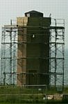
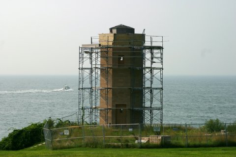
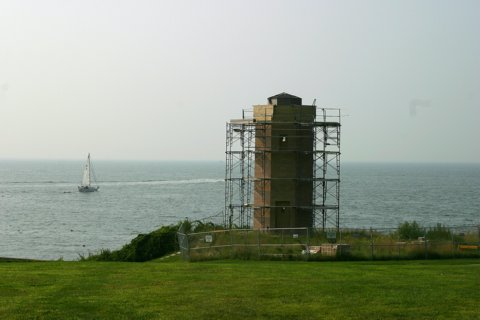
When we last visited the lighthouse it was still under extensive restoration. But since then the restoration has been completed and they've installed a top to the lighthouse. Visit the Avery Point Lighthouse Society for photos of the finished product.

Latitude/Longitude: 41.315188,-72.063511
Nearest Address: 1084 Shennecossett Rd Groton, CT
Directions:
- From Interstate 95 north in Groton, take exit 87. At the end of the ramp get onto SR 349.
- You will be on SR 349 for the remainder of the directions....
- After getting onto SR349, follow it for 0.8 miles and turn right onto Rainville Ave (still SR 349).
- Follow Rainville Ave for about 0.6 miles, then turn left onto Eastern Point Rd. (still SR 349).
- Stay on Eastern Point Rd. for about 1.75 miles where Shennecossett Rd. forks in from the left. Bear right at the lights continuing on Eastern Point Rd. (again, still SR 349).
- After you go past the golf course you'll see the entrance to the Avery Point UConn campus on your right. Bear right into the entrance.
- At the small rotary/roundabout (whatever you want to call it), with the stone police station on your right, take the first right off the rotary and follow that to the lighthouse. From that point you can also see New London Harbor and New London Ledge lights.
View Larger Map
|

