|
Last Visited: July, 2000
History:
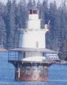
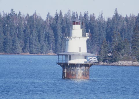
Goose Rocks Light was established in 1890 at the eastern entrance to the Fox Islands Thoroughfare, a busy waterway between Vinalhaven and North Haven islands. The Fox Islands, over 50 in all, were named by explorer Martin Pring after the silver foxes that were common there. Goose Rocks Light is a typical "sparkplug" style cast-iron lighthouse of the era, built on a round cast-iron caisson filled with concrete. The tower, which has three stories inside, originally had a fourth-order Fresnel lens. The tower was painted red until 1903; today the caisson is painted black and the tower is white.
The light was automated in 1963. After automation, for a time there were local people, called "lamplighters," employed to control the fog signal at the lighthouse.
According to Samuel Beverage of the North Haven Historical Society, "Alton Calderwood and his wife, Annie, also Elmer Carver and daughter Marion (Carver) Hopkins served as lamplighters. They lived at Little Thoroughfare not far from the light and were aware of the fog conditions."
The Fresnel lens was removed; there is currently a modern 250 mm optic. The light is now solar powered.
The lighthouse was expected to be turned over to the town of North Haven or a local organization under the Maine Lights Program in the 1990s, but there were no applicants. In June 2004, it was announced that the lighthouse would be transferred to a suitable new owner under the National Historic Lighthouse Preservation Act of 2000. In 2006, the high bidder was Beacon Preservation, Inc. of Ansonia, Connecticut.
Goose Rocks can accommodate up to 6 guests for an all-day or overnight visit as a token of appreciation to those who support our mission of lighthouse preservation. Donations to Beacon Preservation fund 100% of its expensive restoration and upkeep, encouraging us to make Goose Rocks available to those whose financial support provide the foundation for lighthouse survival. Such dedication to lighthouse preservation is often accompanied by a strong desire to experience a real “slice of lighthouse life” with a prolonged visit, offering visitors a chance to absorb the beauty of the Fox Islands as the Goose Rocks lighthouse keepers did for nearly 80 years.
Source:
Maine Sailing Adventures

Latitude/Longitude: 44.135406,-68.830594
Nearest Address: Calderwood Point Rd, Vinalhaven, ME
Directions:
- This was a tough route to take to get to a viewing point for the lighthouse. This is a good time to have a GPS with you.
- From the ferry landing bear right onto Main St.
- In 0.3 miles turn left onto Sands Rd.
- In about 0.4 miles turn right onto North Haven Rd.
- In about 2.5 miles bear right onto Calderwood Neck Rd.
- Take Calderwood Neck Rd. for about 3 miles, then turn left onto Calderwood Point Rd.
- Take Calderwood PointRd. for a bit over 1 mile. The road ends at a private residence, but before the residence there is a field on the right. Beyond the field you can see the lighthouse off in the distance.
View Larger Map
|

