|
Last Visited: February, 2003
History:
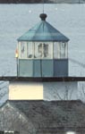
The lighthouse was built between 1981 and 1987 by a local resident. The Coast Guard was convinced to make the lighthouse an official aid to navigation because it sat at a dangerous spot in the harbor called Seal Ledge. Later on the original marine lens was replaced with a 5th order fresnel lens.
Hours:
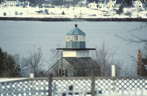
The lighthouse sits on private property, and the tower is not accessible. Respect the privacy of the owners of the residence and the lighthouse. You can get a view from the road.
Personal Note:
We've had a heck of a time finding this lighthouse. It's taken us a few years and multiple trips. In fact, we weren't even actively looking for it this last time when we finally spotted it. We were coming back from Owl's Head Light when we just happened to look to our right and saw this lighthouse!
Books have said that you can go down a dirt road to the light (I think it's CR 230). But these roads look more like driveways and we didn't want to invade anyone's privacy so we took our photos from North Shore Rd.
UPDATE: I received this from someone who emailed into our website. The Rockland Harbor Southwest Light is located at the end of Shearmans Lane in Owls Head. The owner is not always friendly, but if people want a closer look without bothering the owner they are welcome to go to the beach in front of the lighthouse by using a beach path directly beside it that I own and park at the head of the trail. Happy Lighthousing everyone.

Latitude/Longitude: 44.082682,-69.096298
Nearest Address: 11 Shearmans Ln, Owls Head, ME
Directions:
- From Route 1 in Rockland Maine take Route 73 south for approximately 2 miles.
- Take a left onto North Shore Road.
- Drive for about 0.5 miles (slowly). Look off to your left - you should see the lighthouse beyond the houses near the water. If you get to Dynamite Beach Rd. you've gone too far.
View Larger Map
|
![[Photo 2]](https://www.cyberlights.com/lh/maine/images/rocklandsw/rocklandsw02.jpg)

