Wood Island

|
Wood Island Quick Facts
Year Station Established: 1808
Is the Light operational? Yes
Year Light First Lit: 1858
Year Automated: 1986
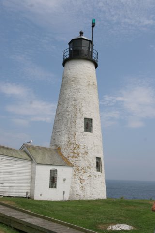
Shape: Conical
Tower Height: 47 ft.
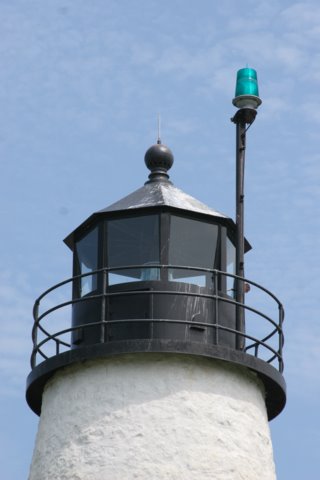
Original Optic: 4th Order, Fresnel
Present Optic: VRB-25
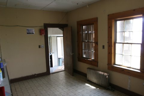
Existing Keepers Quarters? Yes
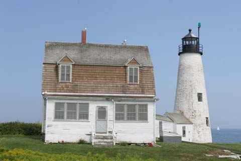
Year Constructed: 1857
Number of Stories: 2
Architectural Style: Colonial
Construction Materials: Wood
|
Wood Island Lighthouse
Biddeford Pool, ME
More Photos
(19 photos, 533KB total download)
Wood Island Lighthouse Videos
[Video]
|
Last Visited: August, 2005
History:
Wood Island Light is located on the northeast side of Wood Island Harbor (Biddeford Pool) and marks the entrance to the Saco River. It is clearly visible from several vantage points along the shore of Biddeford Pool and Hills Beach but the most dramatic is from Audubon Society preserve on Eastern Point at Biddeford Pool. Parking is very limited but the preserve is worth the visit. It is a spectacular wind-blown headland full of wildlife and, if you're lucky, solitude. Trails lead to the harbor side of the point and offer wildly romantic views of crashing surf, harbor islands, the distant crescent of Old Orchard Beach and, of course, Wood Island Light.
The first light on Wood Island, a conical granite block tower and accompanying one and a half story wood frame keeper's house, was erected in 1808. A second tower of the same style replaced the first in 1858. A pub and distillery were located on the island in the 1870s and patrons of that establishment became so merry or loopy one evening that they allegedly set fire to the source of their pleasure. The light station survived the fire.
In the 1940s there was more excitement on the island. According to Tim Harrison, a German submarine had attempted to surrender at Old Orchard Beach. A small landing craft was sent ashore and crew members wandered the town in search of someone to surrender to. It was deep winter and they could not find a living soul in the resort town. The submarine departed the beach and went to nearby Wood Island, the captain assuming that at least the light station would be occupied. They surfaced in Wood Island Harbor, flying a white flag, and the light keeper radioed the appropriate officials.
In 1976, management of twenty-eight of the thirty-six acre island was transferred to the Maine Audubon Society, the balance of the acreage remaining in private hands. The Coast Guard has recently rebuilt a boardwalk from the launching ways on the mainland end of the island to the station on the ocean side. The light was automated in 1986 and the beacon can be seen for sixteen nautical miles. Wood Island is accessible by small boat but extreme caution is advised as the island is infested with a particularly virulent strain of poison ivy.
Source:
maineharbors.com

Latitude/Longitude: 43.45679,-70.329153
Nearest Address: 74 Lester B Orcutt Blvd, Biddeford, ME
Directions:
- Special thanks to our friend Nancy for the directions!
- Take the Maine Turnpike (Route 95) to exit 32 (old exit 4), Biddeford/Route 111
- Turn left at the set of lights onto Route 111 north.
- Follow Route 111 to the 4th set of lights, intersection with Route 1.
- Turn right onto West St. (small road next to Burger King). DO NOT take a sharp right onto Route 1 south.
- Follow West St. 5.7 miles to the end where it intersects Route 9.
- Turn left onto Route 9.
- Follow Route 9 for 1.8 miles and turn right onto Route 208.
- Take Route 208 0.6 miles then take a left onto Mile Stretch Road. (watch out for police radar on this road!)
- This road twists and winds through the town. Keep bearing right. You will pass the fire station on your left. Continue on the road 1.8 miles to the end.
- Park where you can at the end of the road. You will see a small opening in the chain link fence. Follow that path about 300 yards to the end where you will see the lighthouse off in the distance.
View Larger Map
|


|