Conneaut Quick Facts Year Station Established: 1835 Is the Light operational? Yes Year Light First Lit: 1936 Year Automated: 1972 Shape: Pyramidal w/o Lantern Tower Height: 60 ft. Original Optic: Present Optic: 375mm
Existing Keepers Quarters? Yes |
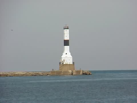
Conneaut West Breakwater Lighthouse
|

 |
More Photos
(3 photos, 23KB total download)
|
Last Visited: August, 2002
History: Source:
Midwest Connection
Latitude/Longitude: 41.979783,-80.55773 Nearest Address: Mariana Dr, Conneaut, OH Directions:
|


| HOME |
Lighthouse Videos |
FREE Screensavers |
Games & Puzzles |
|
| Lighthouse Tours | Lighthouse LINKS | Accomodations | FAQ |
Contact Us |
All pages and photos copyright © 1996-2026,
Gary P. Richardson and Anna P. Klein, unless otherwise noted.
No images or content on this site may be copied or reproduced without prior permission.
Visit Anna and Gary's Website at https://www.photosetc.net
Back to Top