|
Last Visited: February, 2002
History:
Spring Point Ledge Lighthouse was constructed to mark a dangerous ledge which is now covered by the breakwater. Numerous ships had struck the ledge and local ship owners had petitioned the Lighthouse Board for many years before funds were made available for construction.
Finally, in 1891, the ship owners enjoyed success and the Lighthouse Board presented a formal request to Congress to build a fifth-order Lighthouse for an estimated $45,000. The request was denied, but repeated requests finally bore fruit in 1895 when an initial amount of $20,000 was authorized to begin construction. Fifteen months later the remaining $25,000 was made available.
Thomas Dwyer of New York City received the contract from the Lighthouse Board to build a cast iron caisson lighthouse of standard design. Work started in August, 1896 and went quickly until a storm on September 6th deformed many of the 1-1/4-inch iron plates already in place. The damage was estimated at $5,000. Of equal importance was the time lost obtaining new iron plates from the rolling mill in Pennsylvania, which took nearly a month, bringing the December completion date into question.
Work resumed in October and continued at a steady pace until early November when government inspectors halted the job due to the type of cement used to fill the foundation. Construction again stood still for three weeks but the name-calling and finger-pointing did not. In the end, the contractor won out and was allowed to continue. (Incidentally, the cement in question has lasted for more than a century!)
By March of 1897, the tower was complete and painted. The Fresnel lens and lamp apparatus were installed in April, but bureaucratic formalities took several additional weeks. Finally Keeper William A. Lane lit the kerosene lamp for the first time on May 24, 1897. Kerosene remained the source of illumination until the light was electrified in 1934.
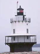
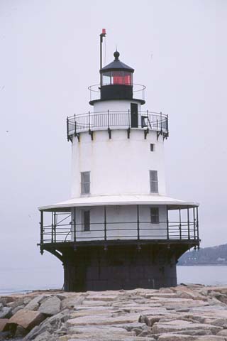
Although it is basically a standard design similar to many other caisson lighthouses, Spring Point Ledge Light is different in several respects. The first floor, used as a cellar for storage of tools and fuel, is actually within the cast iron caisson below the veranda. This makes the structure appear shorter than other similar towers, however, the caisson is built higher than average, putting the focal plane at a height of 54 feet.
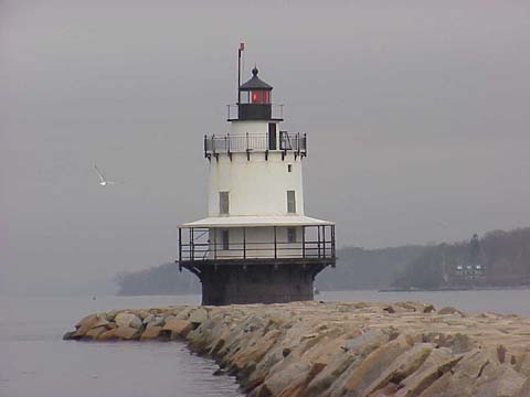
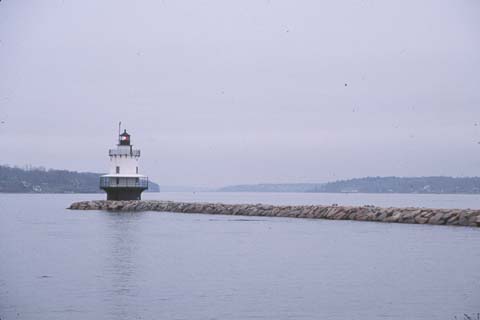
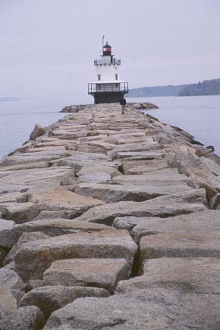
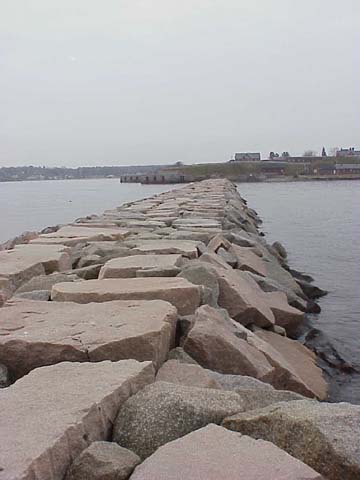
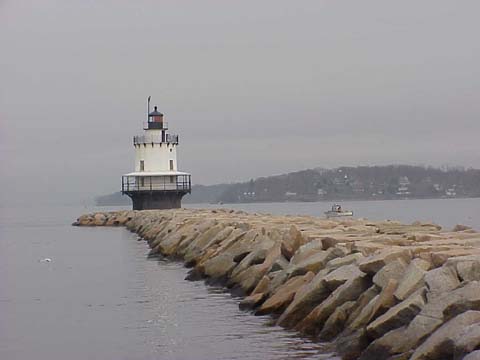
Another unusual facet of the lighthouse is the fact that it is one of the very few lights of this type you can walk around. Nearly all other caisson lights are fully surrounded by water, but the breakwater built by the Army Corps of Engineers in 1950-51, permits Spring Point Ledge Lighthouse to welcome thousands of pedestrians every year.
Now totally automated, Spring Point Ledge Lighthouse still marks the entrance into Portland Harbor by showing a narrow arc of white light (331° - 337°) to a mariner properly positioned in the channel. Outside of the fairway, the light shows two red sectors.
In 1998, the lighthouse was deeded to the Spring Point Ledge Light Trust by the U. S. Coast Guard under the Maine Lights Program. It will continue as an active aid to navigation.
Source:
Spring Point Ledge Light Trust
Hours:
The breakwater is accessible to the public and there is parking nearby. The lighthouse itself is closed to the public. See http://www.springpointlight.org/ for information on special events when the light may be open for tours.

Latitude/Longitude: 43.652162,-70.223969
Nearest Address: 55 Buglight Rd, South Portland, ME
Directions:
- From downtown Portland Route 77 south to Broadway.
- Turn east on Broadway and follow Broadway to Pickett St.
- Turn right onto Pickett St. and follow it to the end.
- Take a left onto Fort Road.
- Follow Fort Road to the end. To the right you will see the lighthouse. Park in the few spaces available and walk thru the park to the breakwater.
View Larger Map
|

