|
Last Visited: July, 2002
History:
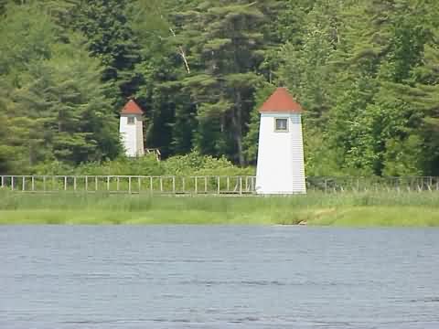
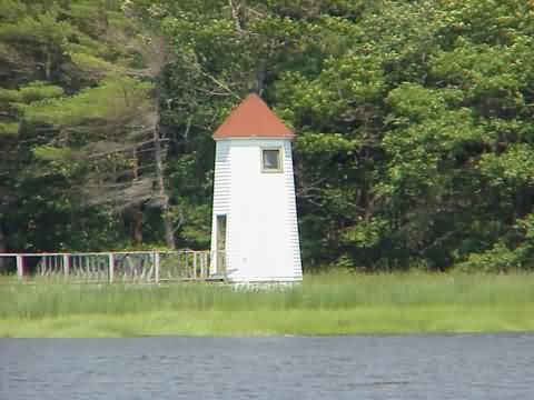
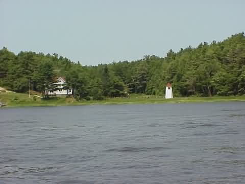
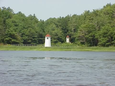
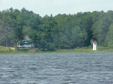
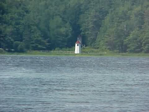
Formerly called the Doubling Point Range Light, this octagonal wooden structure sits 235 yards from an identically shaped rear light along the Kennebec River on Arrowsic Island. It is one of four lights located along the river that guided ships from the Atlantic Ocean to the shipbuilding town of Bath, Maine. (The others are Doubling Point Light, Perkin's Island Light, and Squirrel Point Light.) It currently houses a 250 mm modern lens which was installed in 1980 when the light was automated.
The Kennebec River Range, the only range lights in the First U.S. Coast Guard District, are unique in function, construction, and history.
Proposed for construction by the National Lighthouse Board in 1892, they were funded and built in 1898 and have operated on the Kennebec ever since.
The only range lights of Maine's 64 lighthouses, and among the very few wooden lighthouses in the country, the range lights are twin framed and shingled octagonal buildings, set 235 yards apart. The front light is 18 feet above mean high water, while the rear light is 33 feet above high water. The front light flashes continously, while the rear light shows six quick flashes and an interval.
The Kennebec has always carried heavy sea trade. Though the five-masted schooners no longer come to trade at Bath, Bath Iron Works builds destroyers, frigates, and cargo ships which need to pass up and down the lower ten miles of this fabled river. Because of the navigation to and from BIW, the U.S. Coast Guard has classified the lights as being "of military importance." Mariners coming upriver to Bath line up the two range lights as they pass Ram Island. They follow the lights up the channel until the Doubling Point Light is in view, and then swing to the west for Bath.
The Kennebec River Range Lights were among the very last in the country to be automated. Until 1990 a keeper always tended the range, as well as the Doubling Point and Squirrel Point Lights. One of the last keepers was a woman, Karen McLean, Bo'suns Mate, USCG.
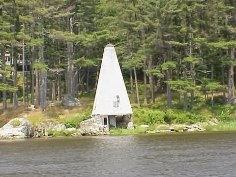
In addition to the Kennebec River Range, the Range Light Keepers have been entrusted with the care of an historic fog bell tower one-half mile upriver from the lights. Since the Coast Guard removed the bell in 1972, the pyramidical structure has fallen into disrepair. The Keepers have undertaken its restoration, with the help of friends, and believe that the bell tower is likely the only Fog Signal of its type undergoing complete restoration. It is the aim of the Keepers to replace the bell and the "clockworks" that drove the striker for many years.
From the Maine Maritime Museum in Bath boat tours feature fine river views of the lights and bell tower.
Source:
Internet Public Library
Source:
The Range Light Keepers

Latitude/Longitude: 43.882862,-69.795652
Directions:
- The lights and fog bell tower can only be seen by boat. See the Lighthouse Tours page at Cyberlights for information on boat cruises in the Bath and Boothbay areas.
|


