|
Last Visited: September, 2000
History:
During the Napoleonic Wars, when Britain and the United States were at economic war, the town of Eastport, Maine grew rapidly as a smuggling canter. Campobello Island, on which Head Harbour Lighthouse was built (part of New Brunswick, but only 12 km away from Maine's coast), also became a trade canter. During the 1820s, trade flourished and traffic grew between Campobello Island and the Maine Coast. Fishing, shipping, and shipbuilding were very important activities in Passamaquoddy Bay, but the famous Fundy fogs, high tides, and treacherous rocks around Campobello Island bit into the profits and hearts of seafaring traders. Head Harbour's light was the first Canadian response to this danger, built to warn sailors approaching the craggy rocks and shoals around Campobello Island. Former American President Franklin D. Roosevelt spent his childhood summers and contracted polio on Campobello Island.
============
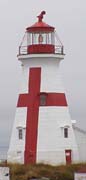
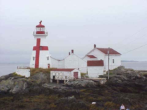
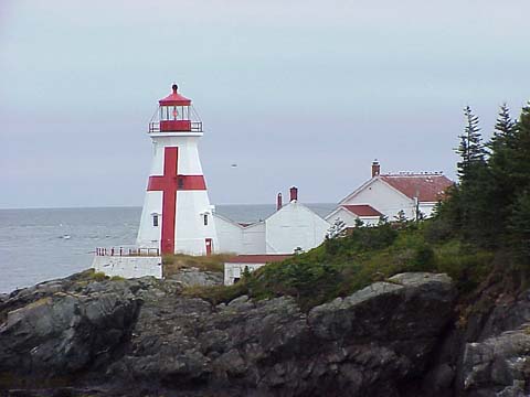
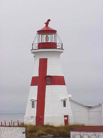
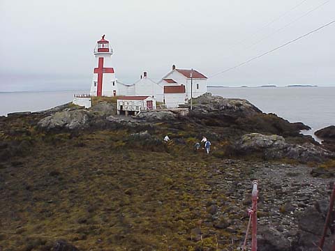
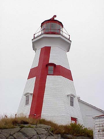
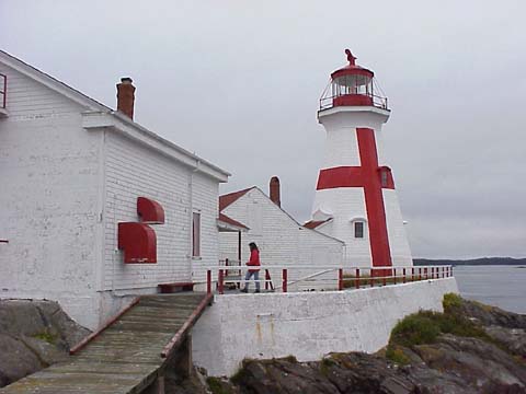
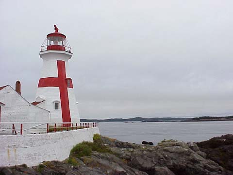
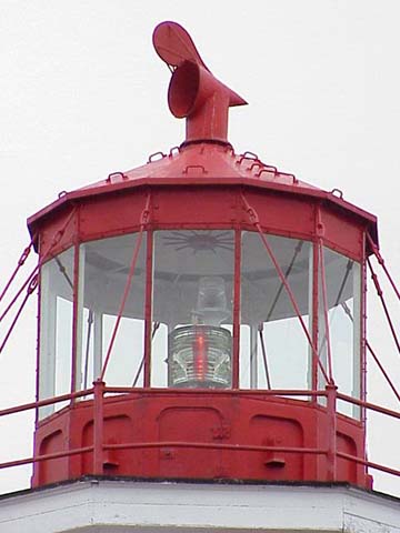
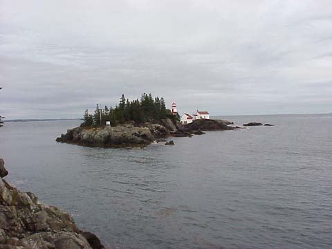
East Quoddy Light is located at the northern point of Campobello Island. The tower is a wooden octagonal shaped tower. The original lantern room was wood but was replaced by the current cast iron lantern room in 1887.
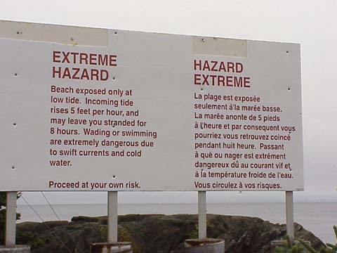
The lighthouse and adjacent buildings sit on a small outcropping of rocks which is accessible by foot for a very short span of time at low tide. You have approximately 1.5 hours to make the crossing to the lighthouse and get back before the tide starts coming in. Once the tide is in you can be stranded for the 8 hour duration of the tide. There are many signs explaining the dangers of crossing over to the lighthouse. There are metal staircases which aid you in making the crossing but many of the rocks are very slippery.
Source:
Friends of Head Harbor Lightstation
Hours:
Easy to list - low tide. You've got a couple of hours at extreme low tide to get over and back. Otherwise, I hope you packed your overnight gear with you. :-) I believe that the Friends of Head Harbor Lightstation are working on gaining control of the properties and may even build a bridge over to the lighthouse. Now that would be nice!
Personal Note:
We visited East Quoddy in the summer of 2000. All the books and webpages warning of the slippery rocks weren't kidding. The rocks at low tide are very slippery. Even in the best hiking boots you still had to be very careful, especially in our case with all the camera gear we carry! Once at the lighthouse it's easy walking. It was a shame to see the condition of some of the buildings but I believe work is being done to restore them (as of 7/2003).

Latitude/Longitude: 44.957859,-66.900657
Nearest Address: Lighthouse Rd Wilsons Beach, NB E5E 1K6, Canada
Directions:
- From Lubec, Maine take Route 189 over the FDR Memorial Bridge into Canada.
- Once on the Canadian side the road turns into Route 774.
- About two miles up the road, it forks. Stay to the right on Route 774.
- Stay on Route 774 for about 7 miles into Head Harbor.
View Larger Map
|

