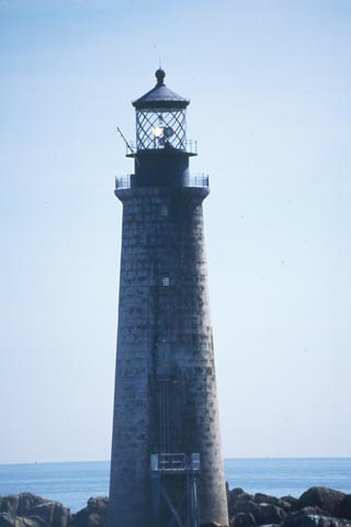
Graves Light

|
Graves Light Quick Facts
Year Station Established: 1905
Is the Light operational? Yes
Year Light First Lit: 1905
Year Automated: 1976
Shape: Conical
Tower Height: 113 ft.
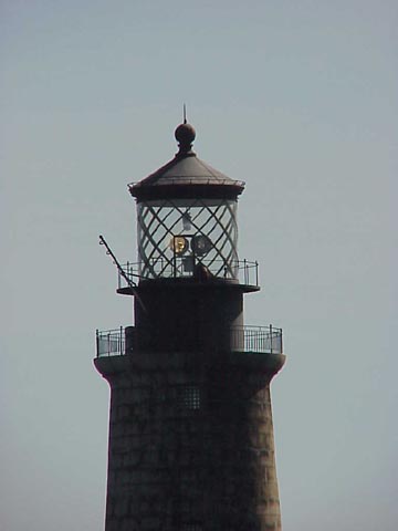
Original Optic: 1st Order, Fresnel
Present Optic: DCB-224
Existing Keepers Quarters? Yes
Year Constructed: 1905
Number of Stories:
Architectural Style: Integral
Construction Materials: Granite
|
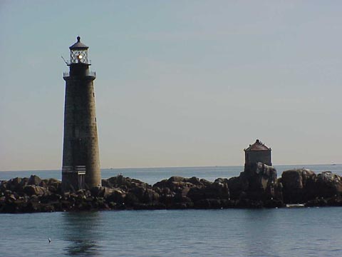
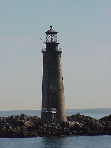
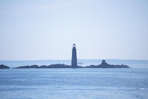
Graves Lighthouse
Boston Harbor, MA
More Photos
(5 photos, 95KB total download)
|
Last Visited: April, 2002
History:
The Graves Light is a lighthouse located on The Graves, the outermost island of the Boston Harbor Islands National Recreation Area, and 9 miles (15 km) offshore of downtown Boston, Massachusetts, USA.
At 113 feet (34m), it is the tallest lighthouse in the approaches to the Port of Boston, and is an important navigation aid for traffic to and from the port. It was built at the same time that the North Channel into Boston Harbor was dredged to become the principal entrance for large vessels. The Graves are the outermost rocks near the outer end of the North Channel.
It was added to the National Register of Historic Places as Graves Light Station on September 28, 1987.
The lighthouse was built in 1905, to a conical design using granite blocks on a granite foundation, and equipped with one of the few first-order Fresnel lens used. The lens assembly stands about 12 ft (4m) tall and is now at the Smithsonian Institution. The light was the setting for the climactic storm in the 1948 film Portrait of Jennie.
Operated by the United States Coast Guard, the light was automated in 1976 and has a characteristic of two white flashes every 12 seconds.
Various sources agree that the ledges were named for a Thomas Graves, but differ on who he was; some prefer a 17th century British Admiral; others like a colonial era American merchant. The USCG history web site shows both.
Many shipwrecks have occurred in the area of the lighthouse, including the the sinking of the City of Salisbury in 1938. In that wreck a million dollars in cargo was lost.
The keepers house was actually 3 of the 5 stories within the lighthouse itself. Amazingly with all the storms that have hit the lighthouse over the years, the oilhouse remains standing.
Source:
Wikipedia

Latitude/Longitude: 42.365144,-70.869134
Directions:
- The light is best viewed by boat. Distant views can be seen from Little Brewster Island, the location of Boston Light. Friends of Boston Harbor Islands offer lighthouse tours which include closeup views of Graves Light. Go to http://www.fbhi.org/ for more information. Also, see our Lighthouse Tours page for additional information.
|


|