Duxbury Pier Light
|
Duxbury Pier Quick Facts
Year Station Established: 1871
Is the Light operational? Yes
Year Light First Lit: 1871
Year Automated: 1964
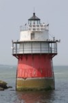
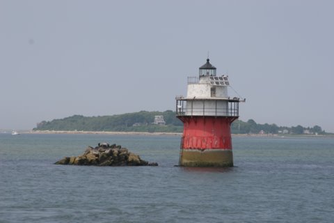
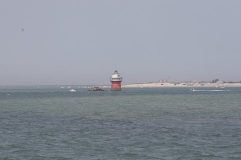
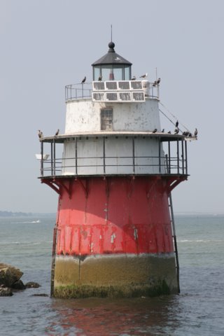
Shape: Conical "Spark Plug"
Tower Height: 47 ft.
Original Optic: 4th Order, Fresnel
Present Optic: 250mm
Existing Keepers Quarters? Yes
Year Constructed: 1871
Number of Stories: 3
Architectural Style: Integral
Construction Materials: Cast Iron
|
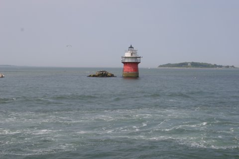
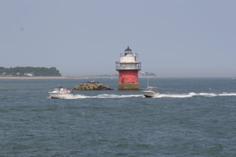
Duxbury Pier Lighthouse
(Bug Light)
Plymouth, MA
More Photos
(6 photos, 107KB total download)
Duxbury Pier Lighthouse Videos
[Video]
|
Last Visited: July, 2006
History:
Duxbury Pier Light was built in 1871 on the north side of the main channel in Plymouth Harbor to mark the dangerous shoal off Saquish Head. The unusual coffeepot-shaped lighthouse is locally known as "Bug Light" or simply "The Bug." The lighthouse contains three levels that were used as living quarters and a watchroom. The lantern room held a fourth order Fresnel lens, first lighted on September 15, 1871.To protect the structure, 100 tons of stones were placed around the base in 1886. A 700-gallon water cistern was added in 1900. The lighthouse was automated in 1964 and the keepers were removed. A modern optic replaced the Fresnel lens. Over the next two decades Duxbury Pier Light fell victim to much vandalism and seabirds made themselves a home in the interior. In 1983 Duxbury Pier Light was slated by the Coast Guard to be replaced by a fiberglass tower much like the one that had replaced Boston Harbor's old Deer Island Lighthouse.
The Coast Guard had estimated that a renovation of the current structure would have cost $250,000. A group of concerned local residents formed Project Bug Light. A five-year lease was granted to the preservation committee. The Coast Guard sandblasted and painted the structure and did some repair work in 1983; the work was completed in 1985. The Coast Guard spent $100,000 to refurbish the lower half of the lighthouse. Project Bug Light raised $20,000 from local businesses, as well as sales of T-shirts and bumper stickers, a fashion show, baseball games, and raffling a painting. They used this money to restore the upper parts and the interior, including the rebuilding of the roof and the catwalk. At the same time solar power replaced the older battery system.
Source:
Project Gurnet & Bug Lights, Inc.
Personal Note:
Although the lighthouse can be seen in the distance from the breakwater in Plymouth Harbor the best views are by boat or air. Below are directions to the Plymouth waterfront where you can either walk the breakwater or take one of the many boat cruises that go by the lighthouse.

Latitude/Longitude: 41.982762,-70.656693
Nearest Address: 96 Water St, Plymouth, MA
Directions:
- From Route 3 south of Boston take exit 6A onto Route 44 east.
- Take Route 44 east for about 0.75 miles to the intersection with Route 3A. At this point Route 44 ends.
- Continue straight at the intersection onto N. Park Ave for about 0.10 miles.
- At this point you'll come to a traffic circle (rotary, roundabout). For free parking go 3/4 of the way around the rotary onto Water St., essentially taking a left. Down there on the right there is a pay lot, and further on a free lot.
- Additionally, if you take a right at the rotary, also onto Water St., there is metered on-street parking.
- See our Lighthouse Tours page for boat and air tours in the Plymouth area.
View Larger Map
|


|