|
Last Visited: October, 2003
History:
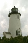
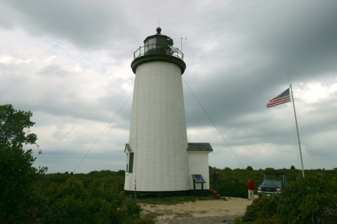
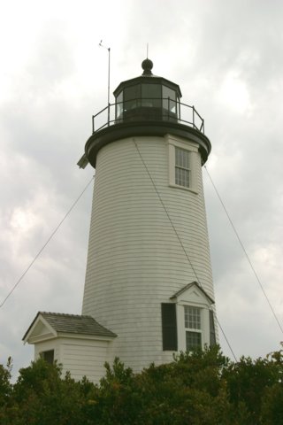
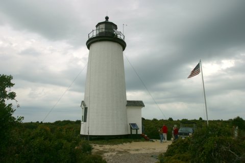
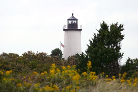
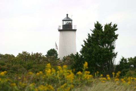
The Cape Pogue Light was the Vineyard's second lighthouse, built at the extreme northeastern tip of Chappaquiddick in 1801.
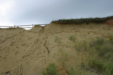
Keeper Matthew Mayhew, who lived at Cape Pogue with his family for thirty-four years, was continually challenged by the encroaching sea. In 1825 he wrote to his superintendent: "It is my opinion that it would be expedient for the dwelling house to be moved the present summer. If we are not in danger of falling immediately down the cliff, it is very unpleasant, particularly to females, to be thus situated in storms when the sea is beating with such violence as for the spray to fly against the house and no other dwelling house within five miles for a refuge."
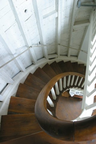
In 1844 the old tower was replaced and by 1878 the keeper's house was again in danger of falling into the sea. In 1893 a "temporary" tower was built. This is the tower which still stands today and it has been moved back from the edge of the eroding cliff four times in the last hundred years. The most recent was in 1987, when the lighthouse was picked up by a sky crane helicopter and moved four hundred feet inland.
Today the Cape Pogue Light-one of the few remaining wooden lighthouses in the world-sits on land owned by The Trustees of Reservations. The keeper's dwelling was torn down in 1954.
======================
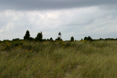
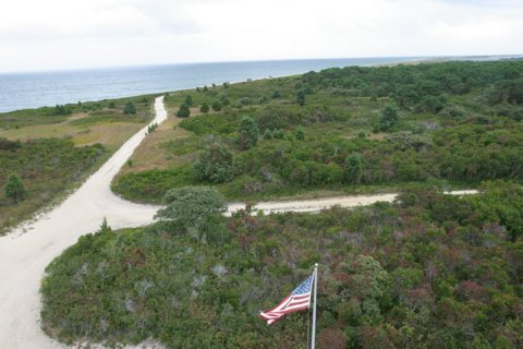
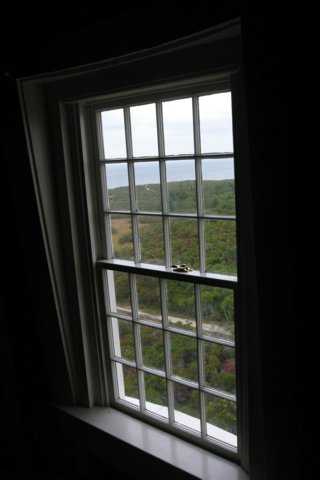
Chappaquiddick Island's eastern edge is a barrier beach formed thousands of years ago by offshore currents that deposited tons of sand. Today this beach extends for seven miles from Wasque Point past the Cape Poge Lighthouse to the Gut.
Tidal waters support extensive salt marshes, especially around Poucha Pond. The Cedars is a grove of century-old, low-growing eastern red cedars sculpted by salt spray and wind. Cape Poge Elbow is home to a gull rookery and nests of piping plovers, least terns, and oyster catchers. West of the dunes lies Cape Poge Bay, where calm, clear waters serve as a nursery for finfish and shellfish. Powerful currents push through the Gut, flushing Cape Poge Bay with oxygen-rich water and attracting striped bass, bluefish, bonito, and albacore.
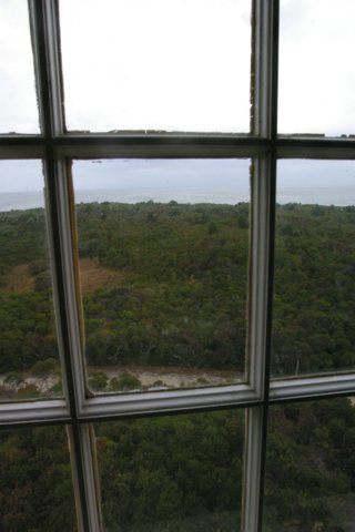
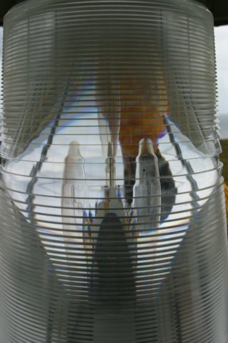
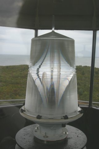
During the early 1800s, the waters around Martha's Vineyard were among the busiest in the world. Cape Poge Lighthouse was built in 1801 to guide ships around the point. The years since 1801 have seen two reconstructions. The present white wooden structure was built in 1893; it is sixty-five feet above sea level and has a six-second flashing white light, which is visible for nine miles.
Source:
Vineyard Gazette Online
Source:
The Trustees of Reservations
Hours:
Seasonal tours allow visitors to explore Cape Poge's lighthouse, diverse upland and marine habitats, and world-renowned fishing spots. Annual over-sand vehicle permits are available for qualified vehicles, providing access to 14 miles of dune roads.
Lighthouse Tour
Travel by over-sand vehicle to the historic and remote Cape Poge Lighthouse. Learn about the fascinating history of the lighthouse and the keepers and their families who lived there.
- Duration: 1.5 hours
- Departure Point: Mytoi parking area.
- Days/Times: Memorial Day to Columbus Day weekend, 9am, 12pm, and 2pm.
- Limit: 12 per tour (including children)
- Reservations: Recommended. Call 508/627-3599. Messages returned.
- Tickets: Trustees members: adult $15, child (15 & under) $10;
nonmembers: adult $20, child (15 & under) $12.
Personal Note:
The tour that the Trustees put on is great! They take 10 people in a 4WD Ford F-250 pickup (there are two bench seats in the bed of the pickup). The drive through the Cape Poge area, along the beaches, to the lighthouse. It was WELL WORTH the cost for the tour.

Latitude/Longitude: 41.418803,-70.451911
Nearest Address: 41 Dike Bridge Rd, Edgartown, MA
Directions:
- From Edgartown take the Chappaquiddick ferry across the harbor.
- On Chappaquiddick take Chappaquiddick Rd. 2.5 miles.
- At a sharp right curve continue straight on Dike Rd. (dirt road) 0.5 miles to Dike Bridge.
- Continue over Dike Bridge to Cape Poge entrance and gatehouse.
View Larger Map
|

