|
Last Visited: September, 2007
History:
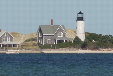
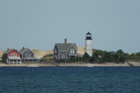
The eastern tip of Sandy Neck -- a half-mile wide, six-mile long, dune-studded peninsula on the north side of Cape Cod -- marks the entrance to Barnstable Harbor as well as the approach to the small harbor at Yarmouthport. Congress appropriated $3,500 for a lighthouse at the eastern tip of the peninsula, a site known as Beach Point, on May 18, 1826. The first lighthouse consisted of a wooden lantern on the roof of a brick keeper's house. The lantern originally held 10 lamps and reflectors, exhibiting a fixed white light 40 feet above mean high water and visible for nine nautical miles.
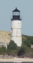
The original lighthouse was replaced in 1857 by the 48-foot brick tower that still stands, slightly north of the first light's location. The distinctive pair of iron hoops and six staves that surround the central part of the lighthouse were added in 1887 as part of an effort to shore up cracks in the tower.
Barnstable Harbor gradually declined in importance, and shifting sands left the lighthouse in a less advantageous position. In the summer of 1931, when William L. Anderson was keeper, the lighthouse was decommissioned and its lens was moved to a steel skeleton tower 200 feet closer to the tip of Sandy Neck. The new automated light was fueled by acetylene gas and was operated seasonally, from April 15 to October 15. The light was discontinued in 1952.
The lantern was removed from the lighthouse and the property was sold at auction in 1933. Recently the Cape Cod Chapter of the American Lighthouse Foundation was able to put in place a new lantern room for the tower.
Source:
New England Lighthouses - A Virtual Guide
Hours:
To access this lighthouse by land you either need a 4WD vehicle and a permit or you'll need to walk about 6 miles over soft sand. It's certainly best seen by boat.
Personal Note:
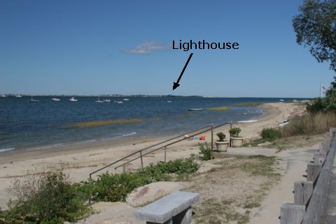
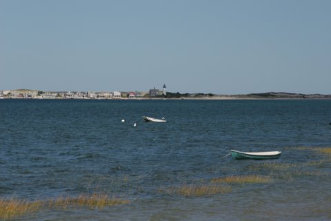
The view of the lighthouse from the parking lot mentioned in the directions below is very distant, about 1.6 miles. If you don't have a long lens for your camera you probably won't get any decent photos. The phots on this page were taken with a 400mm lens and a doubler.

Latitude/Longitude: 41.722659,-70.280974
Nearest Address: 47 Sandy St, West Barnstable, MA
Directions:
- From Route 6 take exit 6 in Hyannis. At the end of the ramp turn north onto Route 132.
- In about 1 mile you'll come to the intersection with Route 6A. Turn right onto Route 6A.
- Take Route 6A for about 2.6 miles then turn left onto Millway.
- Stay on Millway for about 0.6 miles to the end. There's a small parking lot at the end. You'll have a distant view of the lighthouse from the beach side of the parking lot.
View Larger Map
|

