Boon Island Light
|
Boon Island Quick Facts
Year Station Established: 1811
Is the Light operational? Yes
Year Light First Lit: 1855
Year Automated: 1980
Shape: Cylindrical
Tower Height: 133 ft.
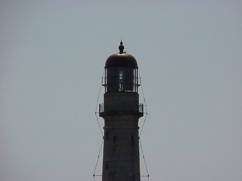
Original Optic: 2nd Order, Fresnel
Present Optic: Vega VRB-25
Existing Keepers Quarters? No
|
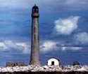
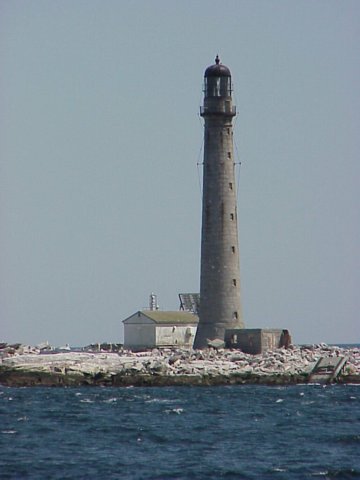
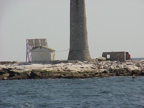
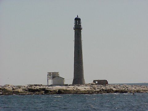
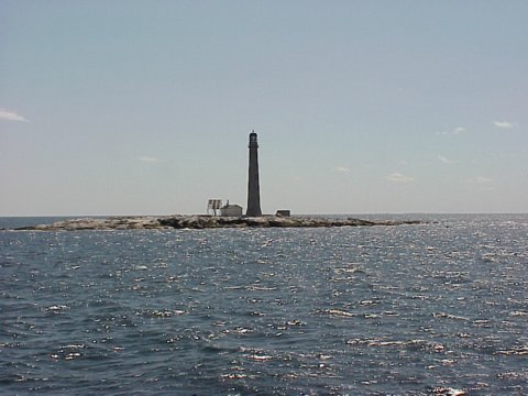
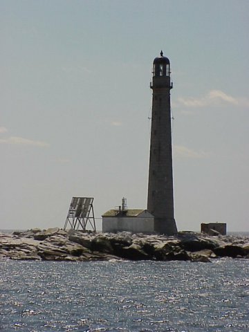
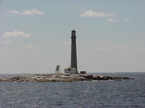
Boon Island Lighthouse
Off the coast of York, ME
More Photos
(8 photos, 192KB total download)
|
Last Visited: April, 2002
History:
Boon Island is located 6 miles off York. The best viewing spot is Sohier Park, across from the Nubble but the 133 foot tower can be seen all along the south coast in good weather. The first lighthouse on the forbidding pile of rock (about 400 yards square) was built in 1799. A cheaply built wooden structure, it lasted a surprising five years before it was blown away. Two more structures were built before the Lighthouse Board really got serious in 1852 and commenced construction on the tower that stands today. Built of hand-hewn granite blocks, the lighthouse has a 25 foot diameter base and is 12 feet across at the top. Boon Island's tower is the tallest in Maine although not the highest above sea level.
Boon Island is subject to such frequent and brutal storms that mainland fishermen began the custom in the last century of placing packages of food and clothing on the island in good weather to help those who would inevitably be wrecked there in foul weather. This custom is the origin of the name of the island. Readers of Kenneth Roberts' novel, Boon Island will recall the desperation of sailors wrecked on Boon which caused them to resort to cannibalism. Apparently the incident actually took place in 1710 when the Nottingham Galley crashed on the barren ledge. The many charms of the place which include deprivation, isolation, threat of starvation and drowning caused a frequent turnover in keepers, although one man stayed on for twenty-seven years. In February of 1978, a ferocious storm caused extensive damage all along the New England coast. On Boon Island the two keepers took refuge in the lantern room while granite boulders were flung all over the islet, destroying the keeper's dwelling, support buildings, part of the helipad and launch ways. In the course of that storm the entire island was submerged. When the ocean calmed down, the high water mark was five feet up the tower. The keepers were rescued by helicopter the day after the storm and the light was automated shortly thereafter. The light can be seen for 18 nautical miles.
Source:
maineharbors.com

Latitude/Longitude: 43.120846,-70.476615
Nearest Address: 8 Sohier Park Road, York Beach, ME
Directions:
- The best view of Boon Island from land can be seen from Sohier Park (at Nubble Light).
- From Route 1 south of York, take Route 1 north and turn onto York St.
- Take York St. 4.9 miles along Long Sands Beach. Just after the beach turn right onto Nubble Road.
- Stay on Nubble Rd. for about 1/2 mile then turn right into Sohier Park.
View Larger Map
|


|
