Indian Island Light
|
Indian Island Quick Facts
Year Station Established: 1850
Is the Light operational? No
Year Light First Lit: 1874
Year Deactivated: 1934
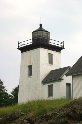
Shape: Square
Tower Height: ft.
Original Optic: 4th Order, Fresnel
Present Optic: Removed
Existing Keepers Quarters? Yes
Year Constructed: 1850
Number of Stories: 1.5
Architectural Style: T-Shaped
Construction Materials: Brick
|
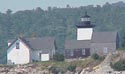
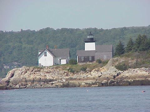
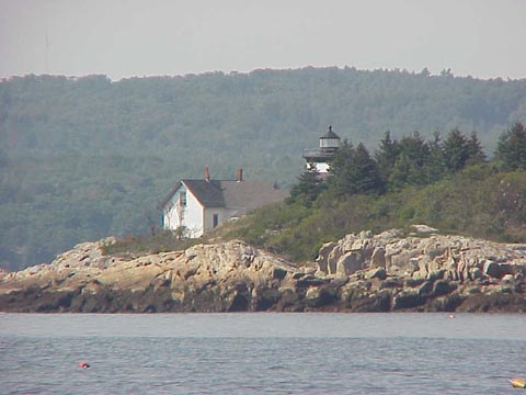
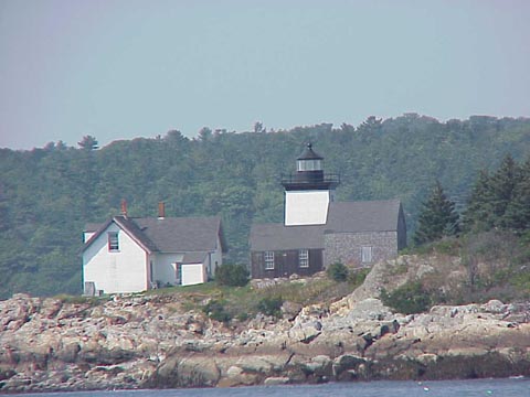
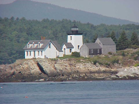
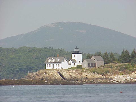
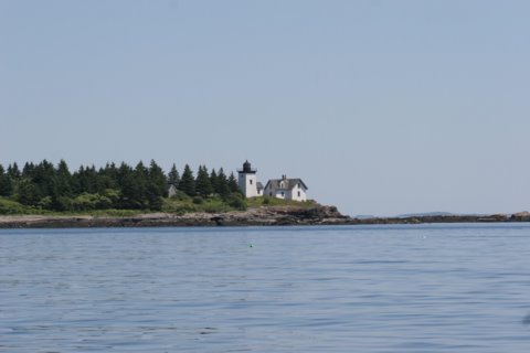
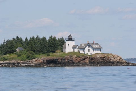
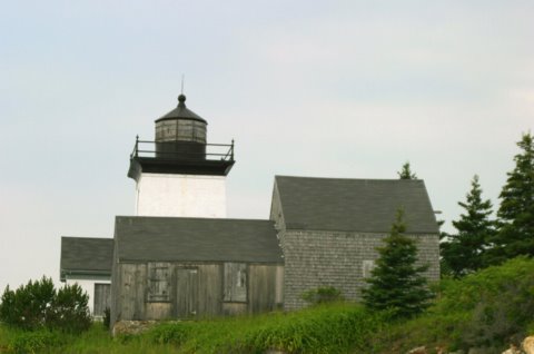
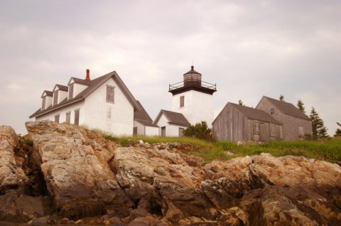
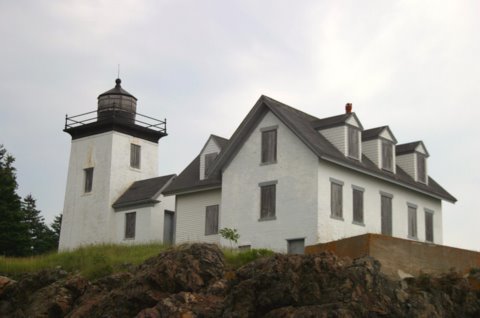
Indian Island Lighthouse
Rockport, ME
More Photos
(13 photos, 378KB total download)
Indian Island Lighthouse Videos
[Video]
|
Last Visited: July, 2005
History:
Indian Island, at the east entrance to Rockport Harbor, was named because local Native Americans took refuge there during the French and Indian War. The island was sold to the U.S. government for a light station by Silas Piper for $25 in 1849.
Established in 1850, the first Indian Island Light was a lantern mounted on the roof of the keeper's house. A fourth order Fresnel lens was installed in 1856. The light was discontinued in 1859, but it was reactivated and a new lighthouse tower was built in 1875 for $9,000. The present Indian Island Light is a square brick tower attached to the original 1 1/2 story T-shaped keeper's house.
Indian Island Light was discontinued in 1934 and replaced by an automatic light on nearby Lowell Rock. The lighthouse property has been privately owned ever since.
Source:
New England Lighthouses - A Virtual Guide
Personal Note:
Even though the directions below bring you to a point at the mouth of Rockport Harbor where you can possibly get some views of the lighthouse, your best views are by boat or air. See our Tours page for various boats tours in Maine that may go by the lighthouse.

Latitude/Longitude: 44.16541,-69.060998
Nearest Address: 80 Hayfield Way, Cushing, ME
Directions:
- In Rockport, from Route 1 take Main St. east for .5 miles.
- Take a left onto Central St.
- In .2 miles take a left onto Central St.
- Take your first right onto Mechanic St.
- In .3 miles Mechanic St. becomes Beauchamp Ave. Stay on Beauchamp Ave. for .6 miles.
- Beauchamp Ave becomes Calderwood Lane. Follow that for .4 miles.
- Just past Chapel Rd. you will take your second right (the first right is JUST after Chapel Rd).
- Follow that road to the end. The road turns into a dirt road but at the end of the road there are places to park and a distant view of the lighthouse.
View Larger Map
|


|