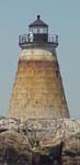
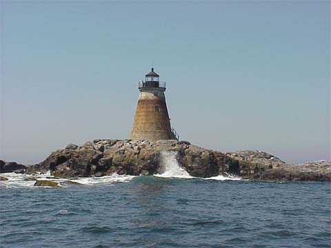
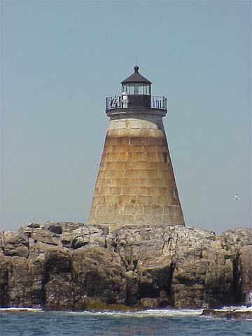
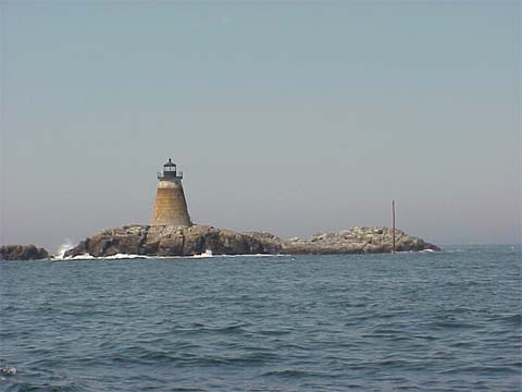
Saddleback Ledge Light
|
Saddleback Quick Facts
Year Station Established: 1839
Is the Light operational? Yes
Year Light First Lit: 1839
Year Automated: 1954
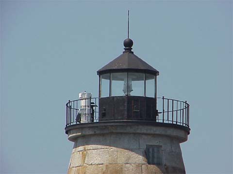
Shape: Conical
Tower Height: 42 ft.
Original Optic: 5th Order, Fresnel
Present Optic: 300mm
Existing Keepers Quarters? No
|
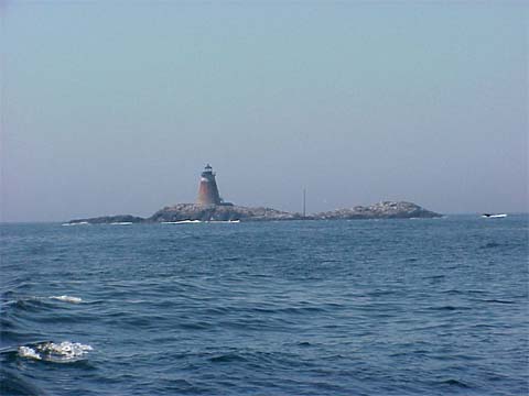
Saddleback Ledge Lighthouse
Isle Au Haut Bay, Maine
More Photos
(5 photos, 99KB total download)
|
Last Visited: July, 2000
History:
Saddleback Ledge is a wave-swept granite outcropping at the southern entrance to East Penobscot Bay (also known as Isle au Haut Bay), approximately four miles from the southeastern corner of Vinalhaven to the west and three miles from the southwestern coast of Isle au Haut to the east.
In 1836, the ship Royal Tar, carrying circus performers and animals, caught fire and sank near the ledge. In March of the following year, Congress appropriated $5,000 for a lighthouse on Saddleback Ledge.
Construction was carried out in 1838–39. Another $10,000 was appropriated for the project in July 1838; the total cost of $15,000 made this an expensive lighthouse for its time.
The lighthouse is a 43-foot-tall conical granite tower with an octagonal wrought wrought-iron lantern. The original lighting apparatus consisted of 10 lamps with 14-inch reflectors showing a fixed white light. The height of the light was described as 63 feet above mean high water in 1943, but current light lists put it at 52 feet.
During a period of rough seas following a storm on November 25, 1951, three keepers—including Osgood and Giffin—were stranded for weeks at the station with, their food and water supplies running low. The storm had badly damaged the attached wooden building and the derrick, and it had also disrupted telephone communications. A Coast Guard plane dropped a walkie-talkie to the keepers, and the Coast Guard tug Snohomish eventually got through with supplies on December 14.
The light was automated in late 1954; the last crew consisted of Thomas Maddock, Thomas Sampson, and Donald Plain. The Fresnel lens was replaced by a modern optic, and the light continued as an automatic aid to navigation. The characteristic is now a white flash every 6 seconds, and an automated fog signal produces a single blast every 10 seconds.
Source:
New England Lighthouses: A Virtual Guide

Latitude/Longitude: 44.014353,-68.726458
Directions:
- Heron Neck Lighthouse can only be seen from boat or plane. Lighthouse cruises out of Camden go past this lighthouse. See our Lighthouse Tours page for more info.
|

|