|
Last Visited: October, 2001
History:
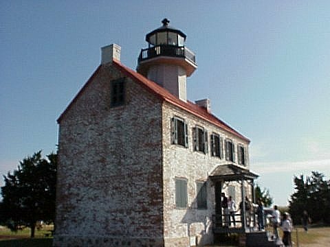
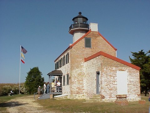
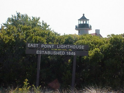
The East Point Lighthouse has played an important part in the maritime history of the Maurice River area of Cumberland County, New Jersey. Originally known as the Maurice River Lighthouse, it was erected in 1849 by the United States Lighthouse Establishment. The present name was initiated in 1913. Throughout the years its guiding light has shown fisherman, oystermen, and recreational boaters the way into the mouth of the Maurice River. During the daylight hours, it has been used as a landmark by hunters, trappers, and surveyors.
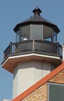
Although numerous lighthouses once stood along the edge of the Delaware Bay, East Point is the last one remaining on the Jersey side. In fact, it is the second oldest lighthouse standing in New Jersey (only the Sandy Hook Lighthouse of 1764 is older). The lantern room offers a panoramic view of the surrounding land and water and is a favorite subject of photographers and painters alike.
The US Coast Guard operated the East Point Light from 1939 until 1941 when the light was extinguished due to the beginning of the war. In 1956 the property was deeded to the New Jersey Division of Fish, Game, and Wildlife. Over the years the vacant structure suffered greatly from vandalism and weather. In early 1971 a group of concerned local citizens formed the Maurice River Historical Society with the goal of saving the historic building from destruction. In July of that year, an incident occurred which nearly doomed the lighthouse; a trespasser in the building caused a fire which destroyed the roof and the lantern room.
Through the mid 1970's, funded only by local fundraising and donations, determined members of the Maurice River Historical Society succeeded in rebuilding the roof and lantern room. Then on July 2, 1980 at public request, the US Coast Guard reinstalled a beacon in the structure and put the East Point Lighthouse back on the list of active navigational aids.
Currently standing at an important crossroads in its history, the future of the East Point Lighthouse is by no means certain. The structure's deteriorated condition needs swift attention if the lighthouse is to be saved for future generations to see. More volunteers are urgently needed, especially those who will take an active part in work parties or on fundraising efforts. As the current level of funding is inadequate to restore the building to its former state, the society is now actively pursuing funding through state and federal grants.
Source:
Cumberland County, NJ
Hours:
For information on tours and events at the lighthouse visit the Eastern Point Lighthouse page of the Maurice River Historical Society.

Latitude/Longitude: 39.195944,-75.027347
Nearest Address: 10 Lighthouse Rd, Port Norris, NJ
Directions:
- From Cape May area take Route 47 north to Heislerville (about 20 miles)
- Take a left onto Route 616 - Glade Rd, which becomes East Point Road.
- Take a right onto Lighthouse Road.
View Larger Map
|

