|
Last Visited: September, 2001
History:
Providence was a thriving center of transportation and commerce by the early 1800s. It became clear that a lighthouse was needed, not only to guide vessels into the Providence River, but also to mark the narrow passage between Nayatt Point and the shoal extending out from Conimicut Point at the opposite side of the river entrance. Congress appropriated $3,500 for the lighthouse on May 23, 1828.
Work progressed quickly and soon a 23-foot octagonal brick tower was completed along with a five-room, unattached stone dwelling.
The focal plane of the light was 38 feet above sea level, and the lighting apparatus consisted of six lamps and reflectors. The concave reflectors were said to be much worn and full of indentations, and two of them were bent from their original forms.
According to an 1859 report, the upper part of the tower was “very much cracked,” and the structure was leaky. The dwelling was also reported to be leaky, with some shingles missing from the roof.
A storm in January 1855 did much damage, and the authorities decided a new tower was in order. Two appropriations of $6,500 each were provided for the work in 1855 and 1856.
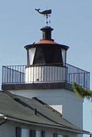
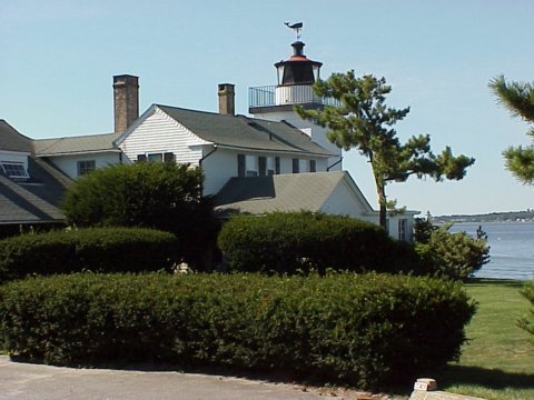
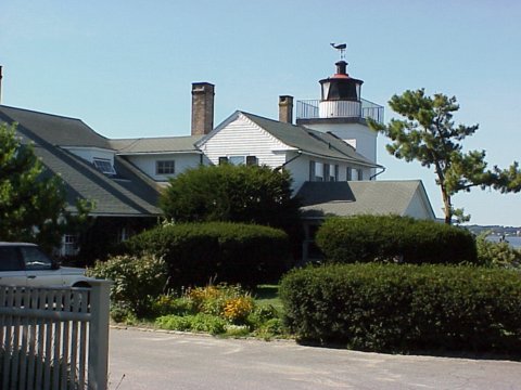
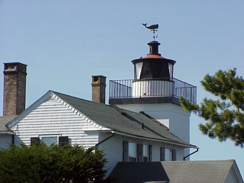
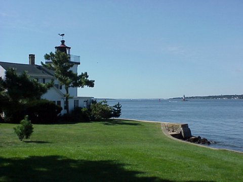
A new 25-foot-square brick tower was completed in 1856. It was attached to the 1828 dwelling by means of a new one-story brick wing added on the building's northwest corner. This wing was raised to two stories, with a gable roof and chimney, about 1905. The tower remains largely unchanged today. A door on the lighthouse's south side leads to a cast-iron spiral stairway leading to the cast-iron lantern room.
The new tower exhibited a navigational light for only about a dozen years. A new granite lighthouse was established offshore to mark Conimicut Shoal, and the light at Nayatt Point was extinguished for good on November 1, 1868. The fourth-order Fresnel lens was transferred to the new structure.
The dwelling at Nayatt Point was retained for use as a shore station for the keepers of Conimicut Light. Keeper Davis Perry rowed back and forth from Nayatt Point—about a mile each way—to tend the new beacon. Several keepers and assistants came and went in the next few years, all of them often hindered by the elements during the treacherous commute across the channel to the lighthouse.
After a new sparkplug-style lighthouse with integral living quarters was built at Conimicut Shoal in 1883, the property at Nayatt Point was sold to Charles Merriman for $4,000. The 1828 house is Rhode Island's oldest lighthouse keeper's house, although there have been additions to the structure.
Len and Barbara Lesko owned the Nayatt Point Lighthouse in recent years. Len Lesko is the chairman of the Egyptology Department at Providence's Brown University. He used the former keeper's office as his study, even using an original 1828 built-in desk overlooking the bay.
When severe weather threatened, the Leskos sealed up the building with heavy hatch covers over all the doors and windows. They never experienced any major storm damage, but did find quahogs on the roof after Hurricane Bob in 1991. The Leskos sold the property in 2001 after owning it for 18 years.
A Fresnel lens from a lightship is now in the lantern room. While the light is operational, it is not an official aid to navigation.
You can get good views of the old lighthouse and Conimicut Light from a nearby beach, but keep in mind that the lighthouse is private property and trespassing is not allowed.
Source:
New England Lighthouses: A Virtual Guide
Personal Note:
Because it's a private residence, it's difficult to drive to the lighthouse to photograph it. However, we rode our bikes down the street and were able to take some photos. One of their neighbors was nice enough to let us walk on his lawn to get a better angle for our photos.

Latitude/Longitude: 41.725189,-71.338869
Nearest Address: 55D Nayatt Point Ct, Barrington, RI
Directions:
- From Providence take Route 195 to exit 6.
- At the end of the ramp take a left onto Route 6.
- At the intersection with Route 103, take a right onto Route 103 (Pawtucket Ave).
- Stay on Route 103 for 4.4 miles and take a right onto Washington Rd.
- Go down Washington Road for 2.4 miles and take a right on Nayatt Rd.
- Take your second left onto Nayatt Point Ct. It's a small road that actually looks like a driveway. Go to the end. The lighthouse is private property so please respect their privacy.
View Larger Map
|

