|
Last Visited: September, 2001
History:
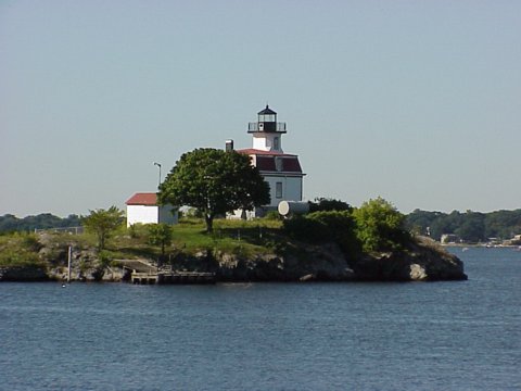
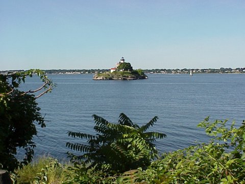
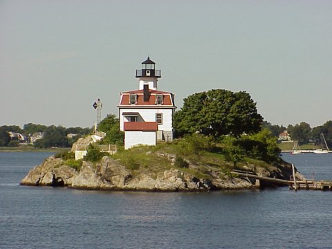
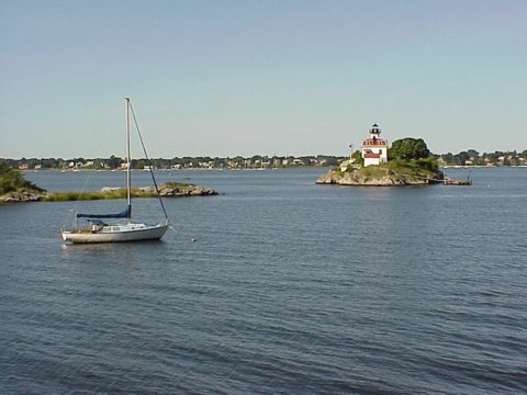
Pomham Rocks is a stark islet of approximately one-half acre rising out of the Providence River, about 800 feet from the east shore in the Riverside section of East Providence.
The name, sometimes spelled "Pumham" in early records, is after a Narragansett Indian sachem who was killed in King Phillip's War in 1676. Some locals will tell you it's pronounced with equal emphasis on both syllables-"POM-HAM" rather than "POM-um."
With increased shipping traffic heading toward Providence, Pomham Rocks was an obvious place to establish a navigational aid. A pyramidal daymark was erected around 1828, but something more was needed to help ensure the safety of the parade of vessels that passed day and night.
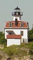
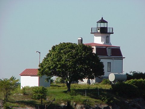
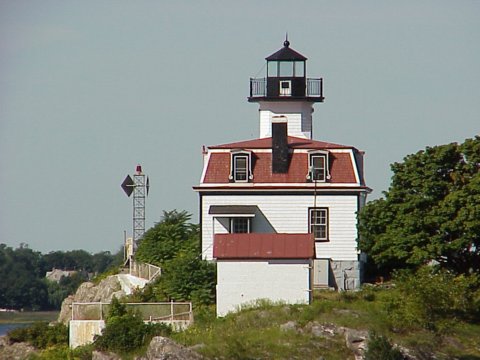
Congress granted an appropriation of $20,000 on July 15, 1870, for three lights on the river-at Pomham Rocks, Sassafras Point, and Fuller Rock. A wooden dwelling with a mansard roof was built on a granite foundation, 28 by 28 feet, with a hexagonal lighthouse tower mounted on the front center of the building.
The lighthouse was first lighted on December 1, 1871, with a sixth-order Fresnel lens (later upgraded to fourth-order) showing a fixed white light. On October 1, 1872, the characteristic was changed to fixed red.
A fog siren was installed at Pomham Rocks in 1900. One newspaper called the new signal, "The Greatest Nuisance in the State."
As complaints from local residents mounted, the continuous horn was soon changed to a three-second blast at 12-second intervals. Three years later a fog bell replaced the siren.
During its last years as an active aid to navigation, the lighthouse was staffed by two Coast Guard keepers, who alternated three days on the island and three days off. The last crews also had the company of two dogs, Jennifer and Pooch-Pooch, who helped keep the rats away from the small island.
Pomham Rocks' original Fresnel lens was replaced by a fourth order lens in 1939. This lens was removed in 1974 and is now on display at the Custom House Maritime Museum in Newburyport, Massachusetts.
The lighthouse was discontinued in 1974 and was replaced by an automatic light on a skeleton tower.
When they learned it was to be decomissioned, the Rhode Island Historical Society stepped in and took temporary possession of the lighthouse. In 1980 the General Services Administration sold the property to the Mobil Oil Company, which has a large refinery and terminal near the lighthouse, for a winning bid of $40,100. Mobil stated that they wanted to "preserve the continuity of the waterfront area."
ExxonMobil leased the historic structure at no cost to the American Lighthouse Foundation. At a meeting in early 2005 in East Providence, a new chapter of the American Lighthouse Foundation, the Friends of Pomham Rocks Lighthouse, was announced. At that meeting, Greg DeMarco, superintendent of ExxonMobil's East Providence terminal, presented $25,000 to the American Lighthouse Foundation toward the restoration of the lighthouse.
Source:
New England Lighthouses: A Virtual Guide

Latitude/Longitude: 41.777681,-71.369487
Nearest Address: 76 Veterans Memorial Pkwy East Providence, RI
Directions:
- In Providence take Route 195. Once on 195 take exit 4.
- At the end of the ramp keep right and get on the Veteran's Memorial Parkway.
- Go for about a mile. At the top of the hill there will be a parking lot on your right. Park there.
- Get on the rail trail bike/walking path and walk for another mile or so. This will bring you right past the lighthouse.
View Larger Map
|

